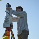
Shane Grigsby
Shane is a Ph.D student in Geography at the University of California, Santa Barbara, where he uses LiDAR and other remote sensing systems to investigate vegetation. During the summer he works as a research mentor to young remote sensing scientists as part of the NASA Student Airborne Research Program (NASA SARP). Prior to his work as an educator, Shane worked as a researcher and a Linux systems administrator at the University of Colorado, Boulder. He has presented his research at the Free and Open Source Software for Geospatial conference (FOSS4G Denver), the American Geophysical Union (AGU), and Google's Boulder, CO office.


